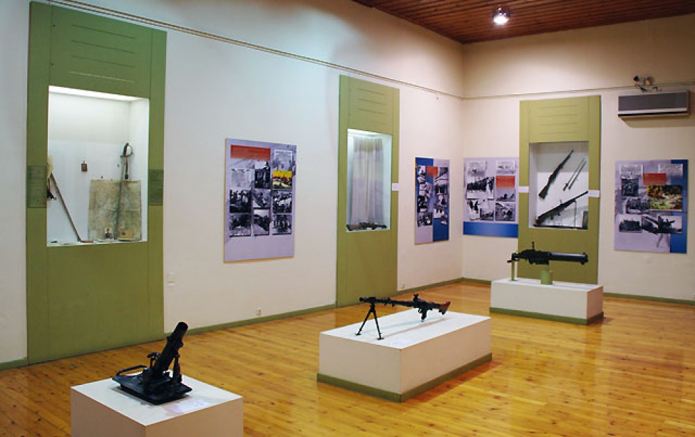
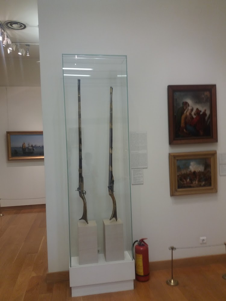
Much of the territory of this region is situated in the Argolid Peninsula. This region is truly blessed and virtually stuffed with ancient archaeological sites – some very famous, like Epidaurus, some less known – as well as archaeological museums.
This route follows a series of dirt roads and tracks skirting along the eastern border of the TAR, taking 4-6 days and starting in the west Sichuan crossroads town of Manigango. It crosses the spectacular 4900m Cho La pass on dirt, descends to a river valley at 3500m, then turns north into the Si Chu Valley along unnamed backcountry track through high grassland dotted with grazing yaks and past tiny villages populated by herders.
This route follows a series of dirt roads and tracks skirting along the eastern border of the TAR, taking 4-6 days and starting in the west Sichuan crossroads town of Manigango. It crosses the spectacular 4900m Cho La pass on dirt, descends to a river valley at 3500m, then turns north into the Si Chu Valley along unnamed backcountry track through high grassland dotted with grazing yaks and past tiny villages populated by herders.

Map & Locations
CULTURE
●●●●●
SCENERY
●●●○○
HIKING
●●●○○
LEISURE
●●●●○
HISTORY
●●●●●
NATURE
●●●○○
CYCLING
●●●○○
FOOD + DRINK
●●●●○
URBAN
●●○○○
CAMPING
●●●○○
MOUNTAINBIKE
●●●○○
ADVENTURE
●●○○○
Destination Information
Hard Facts
- Argolis population: ca. 110,000
- Area: 2,154 km2 (832 sq mi)
- Most important towns:
- Argos (ca. 22,000 inhabitants)
- Nafplio (ca. 15,000 inhabitants)
- Main branches of the local economy: tourism, agriculture (especially oranges and olives)
- Tourists: 1.5 million pers. / year
- Currency: Euro
- Electricity: 220 V / Europlug
- Time Zone: GMT -2
Special Characteristics
- Centre of Mycenaean culture with many archaeological sites.
- Many mythological/Homeric interconnections.
- Many UNESCO World Heritage sites in near distance: Tiryns, Mycenae, Epidaurus, (Mystras/Sparta and Olympia are situated in other parts of the Peloponnes peninsula, but easily accessible)
- The city of Argos is considered among the most ancient continuously inhabited towns in Europe. Signs of settlements can be traced back 7000 years ago to the late Neolithic.
- Argos is also considered to be the origin of the ancient Macedonian royal Argead dynasty, from which Alexander the Great descended.
- Nafplio was the first modern Greek capital.
General Conditions
In July and August, you can expect relatively high temperatures, usually somewhere in the 30’s, but it can be over 40. In May, June and September, temperatures are typically somewhere between 20 and 30 degrees, but they can be both higher and lower, and it may rain, but it rarely lasts long. In the other months the temperature is very variable, it can be over 20 degrees in December while April may have 10. Or vice versa. Long periods of bad weather are rare.
Best Time of the Year
- Unless you want to go to all the festivals or experience an impeccable, cloudless beach holiday, it makes some sense to avoid high season and the height of summer due to tourist numbers and temperatures.
- Go for off-season instead, spring and late summer, especially April/May and September. You can still enjoy a bunch of nice beach days, while not having to share the historical sights and museums with thousands of other visitors.
- Even in early spring and autumn this region has a lot of charme. In March and April, the orange groves are in full bloom. In October and November you`ll see locals picking the fruits from the trees. Olive trees can be harvested from mid-October to sometimes even March.
There are no train connections throughout the Peloponnes peninsula, with the exception of the train Katakolo-Pyrgos-Olymbia. But there are convenient bus connections from Nafplio to Asine/Tolo, Argos, Mykene, Midea, Aspklipiio (Epidauros), Athens, Isthmos (Korinth), Tripoli, Patra, Kalamata.
Classical Music Festival
- Every June, Nafplio arranges a week’s festival of classical music. More information on nafplionfestival.gr.
- The concerts are held on historic sites, like Vouleftikon and Palamidi, so this is a truly unique festival!
Epidauros Festival
- Want to see an play at the ancient theatre in Epidavos? Read about it on our Epidavros page!
Festival Argos – Mykines
- Theatre performances, from Euripides to Shakespeare, dance and music, from traditional Greek to modern, children’s party and fishing festival is something you can enjoy in the Argos and Mykines festival, which takes place in this area every summer between July and September. Some of the plays are set up at the ancient theater of Argos, and is worth a visit just because of the atmosphere. And because many of them are well-known pieces, it is not such a big deal that they are in Greek – which also the information about the festival, sadly, is.
Where to go
All the great sites of Argolis
Argos
Argos is a city in Argolis (Peloponnese, Greece) and is one of the oldest continuously inhabited cities in the world. It is the largest city in Argolis and a major center for the area. Since the 2011 local government reform it has been part of the municipality of Argos-Mykines, of which it is a municipal unit. The municipal unit has an area of 138.138 km2. It is 11 kilometres (7 miles) from Nafplion, which was its historic harbor. A settlement of great antiquity, Argos has been continuously inhabited as at least a substantial village for the past 7,000 years. The city is a member of the Most Ancient European Towns Network.
A resident of the city of Argos is known as an Argive. However, this term is also used to refer to those ancient Greeks generally who assaulted the city of Troy during the Trojan War; the term is more widely applied by the Homeric bards. Numerous ancient monuments can be found in the city today. Agriculture is the mainstay of the local economy.
More Infos: https://www.visitnafplio.com/argos.html
Ancient Argos
Altitide: 14 m
Coordinates: 37.630620, 22.721495
Google Maps | Directions
Argos is traditionally considered to be the origins of the ancient Macedonian royal Greek house of the Argead dynasty. The most celebrated members were Philip II of Macedon and Alexander the Great. As a strategic location on the fertile plain of Argolis, Argos was a major stronghold during the Mycenaean era. In classical times Argos was a powerful rival of Sparta for dominance over the Peloponnese, but was eventually shunned by other Greek city-states after remaining neutral during the Greco-Persian Wars.
There is evidence of continuous settlement in the area starting with a village about 7000 years ago in the late Neolithic, located on the foot of Aspida hill. Since that time, Argos has been continually inhabited at the same geographical location. Its creation is attributed to Phoroneus, with its first name having been Phoronicon Asty, or the city of Phoroneus. The historical presence of the Pelasgian Greeks in the area can be witnessed in the linguistic remainders that survive up to today, such as the very name of the city and “Larisa”, the name of the city’s castle located on the hill of the name.
The city is located at a rather propitious area, among Nemea, Corinth and Arcadia. It also benefitted from its proximity to lake Lerna, which, at the time, was at a distance of one kilometre from the south end of Argos.
Argos was a major stronghold of Mycenaean times, and along with the neighbouring acropolis of Mycenae and Tiryns became a very early settlement because of its commanding positions in the midst of the fertile plain of Argolis.
Archaeological Sites
Altitude: 15 m
Coordinates: 37.631464, 22.719211
Google Maps | Directions
There are a few complexes of ancient sites scattered across the city. The most prominent is the main archaeological complex containing the following sites:
- the Agora (mostly ruins)
- the ancient theater (see below)
- well-preserved ancient baths
- a Roman Odeon
- a well-preserved ancient limestone relief with a rider on a horse
Other sites:
- the Mycenaean cemetery Deirada
- the Sanctuaries of Apollo Deiradiotes and Athena Oxyderkes
- a Kriterion (old court)
- a Nympheon (fountain) from Roman/Hadrian times
- an aqueduct from Hadrian times
- an ancient villa (Casa de Spiridón Tricupis)
- an Isis temple
- some other excavations (Anaskaphés)
Unfortunately, a few of the less prominent ancient sites in Argos are in a rather bad shape.
Ancient Theater of Argos
Altitude: 15 m
Coordinates: 37.631625, 22.719629
Google Maps | Directions
The Hellenistic theater of Argos was built in 320 BC and is famously cut into the hillside of the Larissa Hill. It has 90 steps with a steep incline, forming a narrow rectilinear cavea. The theater is one of the largest architectural developments in Greece and among the largest theaters in Greece. It held up to 20,000 spectators and is divided by two landings into three horizontal sections. Staircases further divide the cavea into four cunei, corresponding to the tribes of Argos. British archaeologist Richard Allan Tomlinson describes the positions of the steps as not conforming to any regular plan, and the blocks are consequently of varying sizes. A high wall was erected to prevent unauthorized access into the theatron and may have helped the acoustics. As shown by excavations in 1988, it is the second of only two known examples of a Greek theater with a circular orchestra – the first one being the theater of the Asklepeion at Epidaurus.
Nearby its site, there´s a second theater. Around 120 CE, both theaters were renovated reflecting the Roman style. The smaller of the theaters was converted to an Odeon. The Romans constructed a proskenion that covered part of the orchestra with a hyposkenion below it. The cavea doesn’t show evidence of renovation so it can be assumed that they remain original. Another notable feature is the Charonian stairway. Actually more like a tunnel, the stairway lead underground from the backstage to the orchestra pit and is presumed to be used to “sudden appear” among the actors in play. Other reports suggest these tunnels were too short and narrow to operate effectively for actors, especially actors in costume.
In direct vicinity of the theater, the ancient Agora and the ancient baths of Argos can be found.
Archaeological Museum of Argos
Altitude: 19 m
Coordinates: 37.634654, 22.726872
Google Maps | Directions
Kapodistrias Barracks (Byzantine Museum)
Altitude: 19 m
Coordinates: 37.634941, 22.725245
Google Maps | Directions
The Byzantine Museum of Argos is located in the Barracks of Kapodistrias, a preservable building with a long history. Built in the 1690s during the Venetian domination of Greece, they initially served as a hospital run by the Sisters of Mercy. During the Tourkokratia, they served as a market and a post office. Later, in 1829, significant damage caused during the Greek revolution was repaired by Kapodistrias who turned the building into a cavalry barrack, a school (1893-1894), an exhibition space (1899), a shelter for Greek refugees displaced during the population exchange between Greece and Turkey (since 1920) and an interrogation and torture space (during the German occupation of Greece). In 1955-68, it was used by the army for the last time; it now also accommodates local corporations and also serves as an exhibition space.
Heraion of Argos
Altitude: 123 m
Coordinates: 37.692005, 22.775
Google Maps | Directions
The Heraion of Argos is an ancient temple in Argos, Greece. It was part of the greatest sanctuary in the Argolid, dedicated to Hera, whose epithet “Argive Hera” (Ἥρη Ἀργείη Here Argeie) appears in Homer’s works. Hera herself claims to be the protector of Argos in Iliad IV, 50–52): “The three towns I love best are Argos, Sparta and Mycenae of the broad streets”. The memory was preserved at Argos of an archaic, aniconic pillar representation of the Great Goddess. The site, which might mark the introduction of the cult of Hera in mainland Greece, lies northeast of Argos between the archaeological sites of Mycenae and Midea, two important Mycenaean cities. The traveller Pausanias, visiting the site in the 2nd century CE, referred to the area as Prosymna (Προσύμνη).
Larissa Castle
Altitude: 271 m
Coordinates: 37.637801, 22.715512
Google Maps | Directions
Larisa is the ancient and medieval acropolis of Argos, located on a high rocky hill, within the town’s boundaries. According to Strabo, it is named for a group of Pelasgians. The summit is occupied by the ruins of a Byzantine-Venetian castle, below it, roughly midway down the slope of the mountain, is Panagia Katakekrymeni-Portokalousa monastery, and the Monastery of Agia Marina (Saint Margaret) at Argos, a nunnery. The site was fortified and in continuous use for nineteen centuries.
Arkadiko Bridge
Altitude: 211 m
Coordinates: 37.593662, 22.937555
Google Maps | Directions
The Arkadiko Bridges, or Kazarma Bridges, are Mycenaean bridges near the modern road from Tiryns to Epidaurus, dating back to the Bronze Age, built in the late Late Helladic III (ca. 1300–1190 BC). The best-preserved main bridge is the oldest arch bridge in Europe and probably even the oldest in the world. It is one of only a few ancient bridges still in its full original existence and use today.
In Mycenaean times, the corbel arch bridges belonged to a highway between the two cities, which formed part of a wider military road network. The main bridge has a culvert span of ca. 1 m and is made in the typical Mycenaean manner of Cyclopean stones. The structure is 22 meters (72 ft) long, 5.60 meters (18.4 ft) wide at the base and 4 meters (13 ft) high. The width of the roadway atop is about 2.50 meters (8 ft 2 in). The sophisticated layout of the bridge and the road indicate that they were specifically constructed for chariots.
There are four known Mycenaean corbel arch bridges near Arkadiko, all belonging to the same Bronze Age highway, and all of similar design and age. One of them is the structure just 100 meters away rom the main bridge to the northeast (37.594331, 22.938573). Another one is the Petrogephyri bridge, which crosses the same stream ca. 700m to the southwest of the main bridge (37.590883, 22.926723). Otherwise similar in size and appearance, the structure has a larger span and a little higher vault. It, too, is still used as a local track.
In direct vicinity, there are also the Tholos Tomb (37.593733, 22.942677) and the Acropolis (37.597024, 22.941977) of Kazarma.
Ancient Asine (Cape Kastraki)
Altitude: 3 m (Acropolis up to 52m)
Coordinates: 37.528341, 22.874343
Google Maps | Directions
Asine (ancient Greek Ασίνη) was an ancient settlement in Greece. It was located on Cape Kastraki near the modern seaside resort of Tolo in the Argolis (Peloponnese). The place has been inhabited since the early Helladikum. Already for earliest times, contacts to the Cyclades, Melos and Crete can be proven. The place had its greatest importance as a port during the Mycenaean period and remained continuously populated even during the sub-Mycenaean and protogeometric period. Asine is also mentioned by Homer in the Catalogue of Ships in the Iliad as one of the places subject to Diomedes, king of Argos. It is said to have been founded by the Dryopes, who originally dwelt on Mount Parnassus.
In one of the early wars (740 BCE) between the Lacedaemonians and the Argives, the Asinaeans joined the former when they invaded the Argive territory under their king Nicander; but as soon as the Lacedaemonians returned home, the Argives laid siege to Asine and razed it to the ground, sparing only the temple of the Pythaëus Apollo. The Asinaeans escaped by sea; and the Lacedaemonians gave to them, after the end of the First Messenian War, a portion of the Messenian territory, where they built a new town (also named Asine). After an interruption of the settlement, a fortified place was built again in the 2nd century B.C.
Nearly ten centuries after the destruction of the city, in the 2nd century AD. its ruins were visited by Pausanias, who found the temple of Apollo still standing, but the place of the ancient settlement still abandoned. Excavations made from 1922 by Swedish archaeologists led by Axel W. Persson (and involving the then Crown Prince Gustav Adolf of Sweden) found the acropolis of ancient Asine surrounded by a Cyclopean wall (much modified in the Hellenistic era) and a Mycenaean era necropolis with many Mycenaean chamber tombs containing skeletal remains and grave goods. Excavations have continued since the 1920s almost continuously under the Swedish Institute at Athens. The site was last used as a fortified position by Italian troops during the second world war when machine gun nests were built.
Mycenaean Cemetery of Dendra
Altitude: 60 m
Coordinates: 37.656876, 22.825315
Google Maps | Directions
Dendra is a prehistoric archaeological site situated outside the village with the same name belonging to the municipality of Midea in the Argolid, Greece. The site has a history stretching back at least to the early Bronze Age and is significant for the Bronze Age cemetery excavated by Swedish archaeologist Axel W. Persson in the first half of the 20th century. Persson excavated an unplundered tholos tomb and many Mycenaean chamber tombs, presumably belonging to the ruling classes having their dwelling at the nearby citadel of Midea.
Subsequent excavations (following partly successful attempts to plunder the unexcavated tombs) unearthed the unique and exquisite Dendra panoply of bronze armour, currently exhibited at the Archaeological Museum in nearby Nafplio. Later excavations also brought to light Bronze Age tumulus burials which included sacrificed horses.
Profitis Ilias Hill
Altitude: 190 m
Coordinates: 37.598707, 22.815654
Google Maps | Directions
Profitis Ilias hill near ancient Tiryns with a orthodox chapel on top, which has a large white cross at the side and is beautifully illuminated at night. During the day the view from the hill at around 200 meters is incredible. At night, it´s a great spot for campers on the huge lower terrace below the church, where you wake up in the morning with a dream view.
There´s also an anecdote concerning Tiryns:
Until the beginning of the 12th century BC, the Lakissa, coming from the east, flowed north past the Profitis Ilias hill and about 1 km further west south past the castle of Tiryns. A mudslide, possibly caused by an earthquake, buried the settlement around 1190/80 B.C. (at the end of Late Helladic III B2) south of the castle. The mud deposit changed the course of the river, which now flowed north past Tiryns.
Probably to prevent another catastrophe, the Lakissa was diverted a short time later (early in the Late Helladikum III C). For this purpose, about 4 km east of Tiryns, shortly after the mouth of two streams into the Lakissa, a 1.5 km long channel was dug from the old riverbed in southwestern direction. Here the canal met the river bed of the Manessi west of the today’s village Ag. Adrianos. This flowed first south of the Profitis Ilias hill and then north of the Agia Kyriaki hill and flowed about 1.5 km south of Tiryns into the Argolic Gulf. The old riverbed was closed with a dam about 10 m high and 300 m long.
Epidaurus
Ancient Epidaurus
Altitude: 7 m
Coordinates: 37.637485, 23.155558
Google Maps | Directions
Epidaurus was a small city (polis) in ancient Greece, on the Argolid Peninsula at the Saronic Gulf. Two modern towns bear the name Epidavros: Palea Epidavros and Nea Epidavros. Since 2010 they belong to the new municipality of Epidaurus, part of the regional unit of Argolis. The seat of the municipality is the town Lygourio.
The remnants of ancient Epidaurus are basically distributed among two areas:
- The complex of the ancient city in Palea Epidavros by the sea
- The complex of the Asklepeion on the hill Kinortio Oros in the back country, ca. 5mi / 8km from the ancient city
Archaeological Site of the Ancient City
Altitude: 8 m
Coordinates: 37.63368, 23.159663
Google Maps | Directions
The ancient Epidaurus was independent of Argos and not integrated into the region of Argolis until the time of the Romans. With its supporting territory, it formed a small territory called Epidauria. Reputed to be founded by or named for the Argolid Epidaurus, and to be the birthplace of Apollo’s son Asclepius the healer, Epidaurus was known for its sanctuary, as well as its theater, which is among the best-preserved ancient theaters and still (again) in use today. The cult of Asclepius at Epidaurus is first attested in the 6th century BC, when the older hill-top sanctuary of Apollo Maleatas was no longer spacious enough.
Acropolis of the Ancient City
Altitude: 33 m
Coordinates: 37.633042, 23.161631
Google Maps | Directions
Archaeological Site of the Asklepeion
Altitude: 327 m
Coordinates: 37.596062, 23.077227
Google Maps | Directions
The Temple of Asclepius was a sanctuary in Epidaurus dedicated to Asclepius. It was the main holy site of Asclepius throughout the ancient Greek world. The sanctuary at Epidaurus was the rival of such major cult sites as the Sanctuary of Zeus at Olympia and Apollo at Delphi. The temple was built in the early 4th century BC. While still in use by the 4th century AD, the temple would have been closed during the persecution of pagans in the late Roman Empire, when the Christian Emperors issued edicts prohibiting non-Christian worship.
Archaeological Museum of Epidaurus
Altitude: 331 m
Coordinates: 37.596699, 23.077915
Google Maps | Directions
The Archaeological Museum of Epidaurus is noted for its reconstructions of temples and their columns and inscriptions. It was established in 1902 and opened in 1909 to display artifacts unearthed in the ancient sites of Epidaurus and the surrounding area.
Ancient Theatre of the Asklepion
Altitude: 343 m
Coordinates: 37.596062, 23.079267
Google Maps | Directions
The Ancient Theatre of Epidaurus is a theatre in the Greek city of Epidaurus, located on the southeast end of the sanctuary dedicated to the ancient Greek God of medicine, Asclepius. It is built on the west side of Cynortion Mountain, near modern Lygourio, and belongs to the Epidaurus Municipality. It is considered to be the most perfect ancient Greek theatre with regard to acoustics and aesthetics.
The prosperity brought by the asclepeion enabled Epidaurus to construct civic monuments, including the huge theatre that delighted Pausanias for its symmetry and beauty, used again today for dramatic performances, the ceremonial hestiatoreion (banqueting hall), and a palaestra. The ancient theatre of Epidaurus was designed by Polykleitos the Younger in the 4th century BC. The original 34 rows were extended in Roman times by another 21 rows. As is usual for Greek theatres (and as opposed to Roman ones), the view on a lush landscape behind the skênê is an integral part of the theatre itself and is not to be obscured. It seats up to 14,000 people.
The theatre is admired for its exceptional acoustics, which permit almost perfect intelligibility of unamplified spoken words from the proscenium or skēnē to all 14,000 spectators, regardless of their seating (see Ref., in Greek). Famously, tour guides have their groups scattered in the stands and show them how they can easily hear the sound of a match struck at center-stage. A 2007 study by Nico F. Declercq and Cindy Dekeyser of the Georgia Institute of Technology indicates that the astonishing acoustic properties may be the result of the advanced design: the rows of limestone seats filter out low-frequency sounds, such as the murmur of the crowd, and also amplify the high-frequency sounds of the stage.
Ancient Stadium of Epidaurus
Altitude: 316 m
Coordinates: 37.597346, 23.073098
Google Maps | Directions
Epidaurus Temple of Artemis
Altitude: 326 m
Coordinates: 37.596963, 23.07716
Google Maps | Directions
Sanctuary of Apollo Maleatas
Altitude: 426 m
Coordinates: 37.599445, 23.085496
Google Maps | Directions
Franchthi Cave
Altitude: 1 m
Coordinates: 37.422441, 23.131262
Google Maps | Directions
Franchthi Cave or Frankhthi Cave is an archaeological site overlooking Kiladha Bay, in the Argolic Gulf, opposite the village of Kiladha in southeastern Argolis, Greece. Humans first occupied the cave during the Upper Paleolithic, appearing around 38,000 BCE (and possibly earlier). Groups continued to live in or seasonally visit the cave throughout the Mesolithic and Neolithic eras, with occasional short episodes of apparent abandonment. Last occupied around 3,000 BCE (Final Neolithic). Along with Theopetra Cave, a similar prehistoric dwelling in central Greece, Franchthi stands out as one of the most thoroughly studied sites from the stone age in southeastern Europe.
More Infos: https://www.visitnafplio.com/frachthi.html
Halieis
Altitude: 9 m
Coordinates: 37.314938, 23.147839
Google Maps | Directions
Halieis (Ancient Greek: Ἁλιεῖς) was a port town of Hermionis, in ancient Argolis at the mouth of the Argolic Gulf. The district is called Halias (ἡ Ἁλιάς) by Thucydides.
The townsfolk derived their name from their fisheries. The Tirynthians and Hermionians took refuge at Halieis when they were expelled from their own cities by the Argives. This town was taken about Olympiad 80 (c. 460 BCE) by Aneristus, the son of Sperthias, and made subject to Sparta. The district was afterwards ravaged on more than one occasion by the Athenians. After the Peloponnesian War Halieis is mentioned by Xenophon as autonomous.
The town was no longer inhabited in the time of Pausanias, and its position is not fixed by that writer. He only says that, seven stadia from Hermione, the road from Halice separated from that to Mases, and that the former led between the mountains Pron and Coccygius, of which the ancient name was Thornax.
Its site is located near the modern Porto Cheli.
Mycenaean Tholos Tomb near Kokla
Altitude: 71 m
Coordinates: 37.613611, 22.691111
Google Maps | Directions
The Mycenaean Tholos Tombs is located near Kokla and a somewhat hidden gem. Also it seems to be closed for the public, but you can manage to get around and take some nice pictures.
Lerna & Myloi
Archaeological Site of Lerna
Altitude: 6 m
Coordinates: 37.550798, 22.716917
Google Maps | Directions
In classical Greece, Lerna was a region of springs and a former lake near the east coast of the Peloponnesus, south of Argos. Even though much of the area is marshy, Lerna is located on a geographically narrow point between mountains and the sea, along an ancient route from the Argolid to the southern Peloponnese; this location could have potentially resulted in the importance of the settlement.
Its site near the village Mili at the Argolic Gulf is most famous as the lair of the Lernaean Hydra, the chthonic many-headed water snake, a creature of great antiquity when Heracles killed it, as the second of his labors. The strong Karstic springs remained; the lake, diminished to a silt lagoon by the 19th century, has vanished.
Lerna is notable for several archaeological sites, including an Early Bronze Age structure known as House of the Tiles, dating to the Early Helladic period II (2500–2300 BC).
Castle of Myloi (Castle of Lerna)
Altitude: 35 m
Coordinates: 37.554498, 22.710169
Google Maps | Directions
Α Frankish castle, visible from a distance and from the sea, on a hill above the famous lake Lerna. Despite its size and its history, it remains relatively unnoticed, since the region is full of impressive and important castles (in Argos and Nafplion).
More Infos: More Infos
Archaeological Site of Midea
Altitude: 238 m
Coordinates: 37.650155, 22.841700
Google Maps | Directions
Midea is a village and a former municipality in Argolis, Peloponnese, Greece. Since the 2011 local government reform it is part of the municipality Nafplio, of which it is a municipal unit. The municipal unit has an area of 178.306 km2, and a population of 5,631 (2011). The seat of the municipality was in Agia Triada.
Within the boundaries of the municipal unit are two significant archaeological sites dating to the bronze age or earlier. One is the site of Dendra located outside the village of the same name. The other is the citadel site of Midea. Both sites were originally excavated by the archaeologist Axel W. Persson between the 1920s and World War II.
Archaeological Site of Mycenae
Altitude: 235 m
Coordinates: 37.730863, 22.756133
Google Maps | Directions
Mycenae is an archaeological site near Mykines in Argolis, north-eastern Peloponnese, Greece. It is located about 120 kilometres (75 miles) south-west of Athens; 11 kilometres (7 miles) north of Argos; and 48 kilometres (30 miles) south of Corinth. The site is 19 kilometres (12 miles) inland from the Saronic Gulf and built upon a hill rising 900 feet above sea level.
In the second millennium BC, Mycenae was one of the major centres of Greek civilization, a military stronghold which dominated much of southern Greece, Crete, the Cyclades and parts of southwest Anatolia. The period of Greek history from about 1600 BC to about 1100 BC is called Mycenaean in reference to Mycenae. At its peak in 1350 BC, the citadel and lower town had a population of 30,000 and an area of 32 hectares.
The first correct identification of Mycenae in modern literature was during a survey conducted by Francesco Grimani, commissioned by the Provveditore Generale of the Kingdom of the Morea in 1700, who used Pausanias’s description of the Lion Gate to identify the ruins of Mycenae.
Nafplio
Ancient City of Nafplio
Altitude: 4 m
Coordinates: 37.565016, 22.800813
Google Maps | Directions
Nafplio is a seaport town in the Peloponnese in Greece that has expanded up the hillsides near the north end of the Argolic Gulf. The town was an important seaport held under a succession of royal houses in the Middle Ages as part of the lordship of Argos and Nauplia, held initially by the de la Roche following the Fourth Crusade before coming under the Republic of Venice and, lastly, the Ottoman Empire. The town was the capital of the First Hellenic Republic and of the Kingdom of Greece, from the start of the Greek Revolution in 1821 until 1834. Nafplio is now the capital of the regional unit of Argolis.
More Infos: https://www.visitnafplio.com/
Nafplio Department of the Greek National Gallery
Altitude: 3 m
Coordinates: 37.566165, 22.804456
Google Maps | Directions
Nafplio Department of the National Gallery of Greece with great paintings and exhibits especially on the Greek War of Independence from the Ottoman Empire and the Greek Revolution. The museum is not very spacious, but nevertheless very rewarding.
Opening Hours:
Monday, Thursday, Saturday: 10:00 – 15:00
Wednesday, Friday: 10:00 – 15:00 & 17:00 – 20:00
Sunday: 10:00 – 14:00
Tuesday: Closed
Entrance Fee: EUR 2.00 (Monday: Free entrance)
Website: https://www.nafplio.gr/en/sightsmenu/nationalgallerynafpliomenu.html


Archaeological Museum of Nafplio
Altitude: 3 m
Coordinates: 37.56611, 22.796277
Google Maps | Directions
The Archaeological Museum of Nafplio is a museum in the town of Nafplio of Argolis, in Greece. It has exhibits of the Neolithic period, Chalcolithic period, Helladic period, mycenaean period, Classical, Hellenistic and Roman periods from all over southern Argolis. The museum is situated in the central square of Nafplio. It is housed on the top floor of the old Venetian barracks.
Vouleftikon Historical Parliament
Altitude: 10 m
Coordinates: 37.56569, 22.796359
Google Maps | Directions
This 18th-century former mosque in the historical center of Nafplio held the first Hellenic Parliament. When the Ottoman Empire invaded the Kingdom of Morea in the Seventh Ottoman-Venetian War, many Venetians were forced to flee the area quickly. Legend has it that when two Venetian brothers went to Nafplio in 1730 to retrieve gold their father left behind, a sinister Agha murdered them and stole the gold. The Agha later felt guilty and decided to use his blood money to gain redemption by funding the construction of a new mosque.
Later that year, construction began on a mosque in the town square. It was built in the traditional Ottoman architecture of the time, using large blocks of gray stone. The main building was square and capped with a large dome, while on the west side there was an arcade that was capped with a smaller dome. A large terrace on the second floor showcased a view over a large portion of the city and port.
Shortly after the Greeks won their independence from the Ottomans, the building was converted for use as the first Hellenic Parliament and operated as such until the capital was moved to Athens in 1826. From 1828 to 1831, the building served as a public gathering place, hosting meetings and dances. In 1831 a Hellenic school opened upstairs but closed the following year. Also opening in 1831 was a prison in the downstairs areas. The prison ceased operating in 1834, but not before serving as the site for treason trials of several Greek revolutionaries who were charged with conspiring against King Otto, including Generals Theodoros Kolokotronis and Dimitrios Plapoutas.
The building mostly sat idle until suffering earthquake damage in 1928, which caused the smaller dome to collapse. The roof was repaired, but the building was still rarely used until the Greek government rehabilitated it and turned it over to the Ministry of Culture, which currently uses a portion to house the Municipal Art Gallery of Nafplio.
Opening Hours:
The hours of operation are sporadic and are generally dependent upon the building’s use as a museum. The second floor terrace is accessible most days and evenings and has a nice view over a portion of the city. The outer courtyard of the property hosts a collection of rare relics.
Nafplio Harbor
Altitude: 0 m
Coordinates: 37.566384, 22.793829
Google Maps | Directions
Along the harbor there are a lot of cafes and restaurants, which are rather touristic here. Not far away from the long pier you will find the “Five Brothers” – five old cannons, which were supposed to guard the harbor entrance, together with the Bourtzi fortress. From here you can walk along the Arvanitia Trail all the way around the little promontory which is crowned by the Acronauplia fortress. The gates are only half-heartedly closed and obligatory signs warn against stone falls. Those who still dare to take the promenade path with the lighthouse will enjoy some wonderful views to the Argolic Gulf and the fortress Palamidi, especially at dusk, and reach the small Arvanitia city beach after their walk. From here you´re just one stone’s throw away from Nafplio old town again. The staircase to Palamidi fortress is also here.
Water Castle Bourtzi
Altitude: 2 m
Coordinates: 37.569707, 22.790401
Google Maps | Directions
The water castle of Bourtzi is a Venetian castle, located in the middle of the harbour of Nafplio.
Fortress Acronauplia
Altitude: 59 m
Coordinates: 37.56456, 22.796447
Google Maps | Directions
The Acronauplia is the oldest part of the city of Nafplion in Greece. Until the thirteenth century, it was a town on its own. The arrival of the Venetians and the Franks transformed it into part of the town fortifications. Later, part of it was used as a prison until the Greek government decided that the view provided from its location would benefit the local tourism and built a hotel complex which still stands there today.
Palamidi Venetian Fortress
Altitude: 216 m
Coordinates: 37.56204, 22.803873
Google Maps | Directions
Palamidi is a fortress to the east of the Acronauplia in the town of Nafplio in the Peloponnese region of southern Greece. Nestled on the crest of a 216-metre high hill, the fortress was built by the Venetians during their second occupation of the area (1686–1715).
The fortress was a very large and ambitious project, but was finished within a relatively short period from 1711 until 1714. It is a typical baroque fortress based on the plans of the engineers Giaxich and Lasalle. In 1715 it was captured by the Turks and remained under their control until 1822, when it was captured by the Greeks.
The eight bastions of the fortress were originally named after the Venetian provveditori. However, when it fell to the Ottoman Empire, the bastions were given Turkish names. Lastly, when the Greeks overthrew the Turks the bastions were renamed after ancient Greek leaders and heroes (Epaminondas, Miltiades, Leonidas, Phocion, Achilles, Themistocles. The two remaining bastions were named after St. Andrew (Agios Andreas) and the French Philhellene Robert who died in battle on the Acropolis of Athens. The “Miltiades,” was used as a prison and among its walls was also held Theodoros Kolokotronis, hero of the Greek Revolution.
The fortress commands an impressive view over the Argolic Gulf, the city of Náfplio and the surrounding country. There are 913 steps in the winding stair from the town to the fortress. However, to reach the top of the fortress there are over one thousand. Locals in the town of Nafplion will say there are 999 steps to the top of the castle, and specials can be found on menus that incorporate this number to catch a tourist’s eye.
Karathona Beach
Altitude: 1 m
Coordinates: 37.545642, 22.821347
Google Maps | Directions
The natural bay of Karathona south of Nafplio with its long sandy beach is one of the prettiest in the area and make it a nice place for a swim, as well as an ideal stop to relax after visiting the Palmidi fortress. The archaeologist Evangelia Protonotariou-Deilaki found prehistoric tools, bones and ceramics in Kokkinovrachos, above the shore of Karathona. On the small island of Karathona, there was a small church dating from the middle ages that was dedicated to Aghios Theodoros. Today the Karathona area boasts many beautiful churches such as: Aghia Paraskevi; the Church of Panaghia Katakekrimmeni, hidden in the rocks; Aghios Konstantinos and Aghios Nikolaos Krassoktistos.
You can get to Karathone either by road, around the mountain on which the Palamidi fortress was built, going uphill along 25th March Street and crossing the Pronia neighbourhood; or on foot, continuing the Arvanitia Promenade (which has a beach as well). A few beach bars like the “Outopia” open in summer. In low season, it´s a great place for wild camping and campervans.
Mycenean Tholos Grave in Ancient Prosymna
Altitude: 122 m
Coordinates: 37.695972, 22.769972
Google Maps | Directions
Prosymna was an ancient (Myceneaen) settlement in Argolis and a place that seems to have been inhabited since the Neolithic period. Pausanias reports that Prosymna was named after Greek mythological figure of Prosymna, together with her sisters Acrea and Euboea one of the nurses of the goddess Hera, and constituted an area below the celebrated Heraeum, or temple of Hera. According to Strabon and Stephanos of Byzantium, Prosymna was the town in whose realm the Hera temple stood.
In 1878, archaeologist Panagiotis Stamatakis found a tomb in the form of a tholos that was built during the Mycenaean epoch and that was also reused in later periods. Archaeological investigations continued under the auspices of the Swedish Institute at Athens in the 1930s and then during the 1980s and 1990s, that found two settlement areas on two different sides of the Mastos hill slope, belonging to the Ancient Helladic and the Recent Heladic periods, respectively. They have found chamber tombs and large amounts of pottery that testify that the place was an important center of production of this material for many centuries. During the Hellenistic period and the early and late Roman the area also experienced a boom.
Tolo Beach
Altitude: 4 m
Coordinates: 37.521175, 22.859754
Google Maps | Directions
Tolo is a small village in Greece on the Peloponnese peninsula. It is part of the municipal unit Asini, in Argolis. Tolo has a history reaching as far back as to Homer`s Iliad, but turned into a summer holiday resort in the 20th century with lots of bars, restaurants, and a long sandy beach.
Tiryns
Tiryns Archaeological Site
Altitude: 12 m
Coordinates: 37.599526, 22.799595
Google Maps | Directions
Tiryns is a Mycenaean archaeological site in Argolis in the Peloponnese, and the location from which mythical hero Heracles performed his 12 labors. Tiryns was a hill fort with occupation ranging back seven thousand years, from before the beginning of the Bronze Age. It reached its height between 1400 and 1200 BC, when it was one of the most important centers of the Mycenaean world, and in particular in Argolis. Its most notable features were its palace, its Cyclopean tunnels and especially its walls, which gave the city its Homeric epithet of “mighty walled Tiryns”. Tiryns is linked with the myths surrounding Heracles, as the city was the residence of the hero during his labors, and some sources even cite it as his birthplace.
The famous megaron of the palace of Tiryns has a large reception hall, the main room of which had a throne placed against the right wall and a central hearth bordered by four Minoan-style wooden columns that served as supports for the roof. Two of the three walls of the megaron were incorporated into an archaic temple of Hera. The site went into decline at the end of the Mycenaean period, and was completely deserted by the time Pausanias visited in the 2nd century AD. This site was excavated by Heinrich Schliemann in 1884–1885, and is the subject of ongoing excavations by the German Archaeological Institute at Athens and the University of Heidelberg. In 1300 BC the citadel and lower town had a population of 10,000 people covering 20–25 hectares. Despite the destruction of the palace in 1200 BC, the city population continued to increase and by 1150 BC it had a population of 15,000 people.
Tiryns was recognized as a World Heritage Site in 1999.
Entrance Fee: EUR 2.00
Tholos Tomb Tiryns
Altitude: 15 m
Coordinates: 37.596476, 22.812459
Google Maps | Directions
The tomb of Tholos of Tiryns (Greek Θολωτός Τάφος Τίρυνθας) is an underground Tholos building which was erected during the Late Helladic period around 1300 BC. It was excavated in 1913 by Hans Dragendorff under the direction of Georg Karo.
The tomb is located about 1 km east of Tiryns Castle at the western foot of Profitis Ilias Hill. The dromos is 13.70 m long and 3 m wide and runs from west to east. It is built of coarsely hewn limestone slabs. The façade was decorated with spirals. The gate way (Stomion) is about 5 m long, 4 m high and 2 m wide. It is covered with three thick stone slabs. While the relief triangle above the capstones has disappeared on the outside, it can still be seen inside. The grave could be closed with a two-wing door.
Ancient Tiryns Dam
Altitude: 70 m
Coordinates: 37.607858, 22.843359
Google Maps | Directions
2 km east of Nea Tiryns and about 5 km from Tiryns Castle a unique technical work of antiquity was discovered. In this area a huge earth wall was built, surrounded by a cladding of stone blocks – some stone blocks are visible today – to drain the water from the Manesi stream, which seems to have flowed towards Tiryns and had caused flooding since the early Bronze Age (FH II).
Further Sites in Attika
Not strictly in Argolis, but nearby
Megali Magoula near Galatas
Altitude: 24 m
Coordinates: 37.501811, 23.422989
Google Maps | Directions
Megali Magoula (Greek Μεγάλη Μαγούλα, large hill) is an archaeological site near the Greek port of Galata. The excavations brought to light a Mycenaean dome with dromos and other tombs and sacrificial sites, as well as a Mycenaean acropolis. Some of these finds are exhibited in the Archaeological Museum of Poros.
Methana Peninsula
Mycenaean Megaron Sanctuary
Altitude: 100 m
Coordinates: 37.593619, 23.401685
Google Maps | Directions
Island of Poros
Ancient City of Troezen
Altitude: 32 m
Coordinates: 37.503419, 23.348374
Google Maps | Directions
Troezen was an ancient town and healing sanctuary in the northeastern Peloponnese, Greece, on the Argolid Peninsula. According to Greek mythology, Troezen came into being as a result of two ancient cities, Hyperea and Antheia, being unified by Pittheus, who named the new city in honor of his deceased brother, Troezen. The ancient city had a spring that was supposedly formed where the winged horse Pegasus once came to ground.
Troezen is the setting of Euripides’ tragedy Hippolytus, which recounts the story of the eponymous son of Theseus who becomes the subject of the love of his stepmother, Phaedra. While fleeing the city, Hippolytus is killed when his chariot is attacked by a bull rising from the sea. A cult built up in the ancient city around the legend of Hippolytus. Troezen girls traditionally dedicated a lock of their hair to him before their marriage.
Before the Battle of Salamis (480 BC), Athenian women and children were sent to Troezen for safety on the instructions of the Athenian statesman Themistocles. In 1959, a stele was found in a coffee house in Troezen, depicting the Decree of Themistocles, the order to evacuate Athens. The stele has since been dated to some 200 years after the Battle of Salamis, indicating that it is probably a commemorative copy of the original order.
Posts related to Argolis
From Travel Blog, Series, Trails & Tours
Did you like this?
Say hello via social media or drop me an e-mail...
![]()
![]()
![]()
![]()
![]()
![]()
![]()
![]()
![]()
![]()
![]()
![]()
Become Our Trail Angel
Support our work
If you are truly grateful for the impressions and inspiration you receive through travel4stories, we would be delighted if you would become one of our “Trail Angels” and help fill our little digital piggy bank with travel karma. This project is only possible thanks to supporters like you. Even small amounts carry us over long distances.
What goes around, comes around… As a proof, I say thank you for every single donation with a beautiful postcard—mailed directly to your (or a friend´s) physical mailbox. All you have to do is fill in the desired address. Recurring donors get multiple postcards per year. If you don´t need/want postcards, you can still use the donation form and just ignore the address lines.
*Click on the button above and follow three simple steps in the pop-up form of our trusted partner donorbox. Checkout is possible via credit card and PayPal. You can select a one-time or a recurring donation. For recurring donors, a donor account is created automatically. Account setup info will be mailed to you. You have full control over your donation and you can cancel anytime. Your personal data is always secure.
If you prefer donating in other ways, you can become our Patreon, or support us directly via PayPal.
The possibilities to support us with good travel karma are near endless.
Please click here to see them all.
We would like to thank all our supporters from the bottom of our hearts!
Read Great Stuff
Discover Stories & Images, Tours & Trails, Travel Series, and More...
Comments
We´re curious what you think